Download Continental Drift Theory – Geography and more Study notes Geology in PDF only on Docsity!
Continental Drift Theory – Geography
Study Material & Notes
Continents cover 29 percent of the surface of the earth and remainder is under oceanic waters. Alfred Wegner was a German meteorologist who put forth the Continental Drift
Theory in 1912.
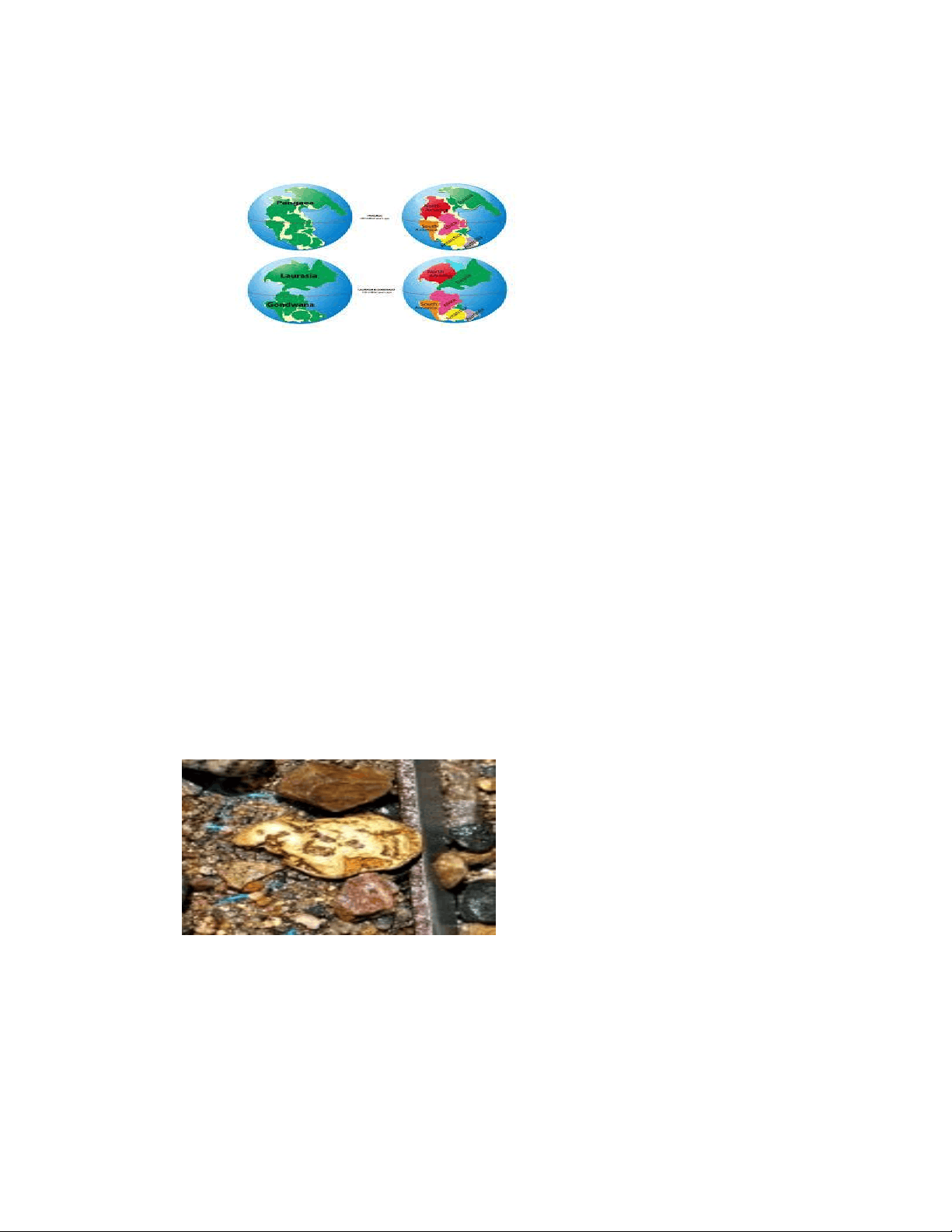
It is considered that there was a single landmass called PANGAEA- which means all earth. The mega-ocean is called PANTHALASSA – which means all water.
The basic argument was that – About 200 million years ago, the mega-landmass PANGAEA started splitting into two large landmasses namely, LAURASIA in the north and GONDWANALAND in the south. These two landmasses kept splitting till they they reached present configuration of continents and oceans.
The argument for the C ontinental Drift Theory gets strength from the following evidences:
- Matching of Continents in a Jig-Saw-Fit: The shorelines of Africa and South America towards each other show a remarkable match.
- Rocks of same age across the oceans: It is established by radiometric dating methods that the earliest marine deposits along the coastline of south america and Africa are of Jurassic age, this suggest ocean did not occur prior to that. A belt of ancient rocks of 2,000 million years from Brazil coast matches with those from Western Africa.
- Tillite: It is sedimentary rock formed out of deposits of glaciers. Gondwanaland system of sediments has its counterparts in six different
Placer Deposits
landmasses of Southern Hemisphere. Thick tilliation at base shows prolonged glaciation. Counterparts of this succession are found in Africa, Falkland island, Madagascar , Antarctica and Australia besides India. It proves paleoclimates and drifting of continents. These landmasses have similar histories.
- Placer deposits : Occurrences of rich placer deposits of gold in Ghana coast and the absolute absence of source rock in the region. Also, presence of gold bearing veins in
Brazil show that obviously gold deposits of Ghana are derived from Brazilian plateau when they were together.
- Distribution of fossils: Lemurs occur in India, Madagascar, and Africa, this information leads to consideration of these three landmasses being connected in the past, hypothetically named” Lemuria”. Also Mesosaurus ( a small reptile living in brackish water) skeleton have been found only in two localities – South Africa and Iraver formation of Brazil, which are 4,800 km apart presently.
According to Wegener, forces responsible for this Continental drifting are:
- Pole-fleecing force – rotation of earth.
- Tidal force – This is due to attraction of moon and the sun that develops tides in oceanic waters.
Post drift studies have shown some progress with following noteworthy points:
Convectional current Theory: Arthur Holmes in 1930s discussed the possibility of convection currents operating in the mantle portion. These currents are generated due to radioactive elements causing thermal differences in the mantle portion. Mapping of the oceanic floor: Dating of rocks from oceanic crust reveal that they are much younger than continental areas.
Plate Tectonics
Tectonic plate/ lithospheric plate is a massive , irregularly shaped slab of solid rock , generally composed of continental and oceanic lithosphere. Plates move horizontally over the aesthenosphere as rigid units. these can be called oceanic or continental based on which area is major on the plate. Theory of plate tectonics proposes that – Earth lithosphere is divided into seven major and some minor plates.
- Antarctica and surrounding oceanic plate
Sites of pulling away : Spreading sites. Example, Mid-Atlantic Ridge, at this the American Plate is /are separated from the Eurasian and African Plates.
II. Convergent Boundaries:
Where crust is destroyed as one plate dived under another. The location where sinking of plate occurs is- Subduction zone. Three ways of convergence are: a) between oceanic and continental plate; b) between two oceanic plates; c) between two continental plates.
II. Transform Boundaries:
Crust is neither produced, nor destroyed as the plates slide horizontally past each other. Transform faults are the planes of separation generally perpendicular to mid-oceanic ridges. Since eruption is irregular, differential movement of a portion of plate away from axis of earth. Also, rotation of earth has its effect on separated blocks of plate portions.
Rates of plate movements determined by the strips of normal and reverse magnetic field that parallels the mid-oceanic ridges.
Heat within earth comes from two sources –
- Radioactive decay
- Residual heat
The slow movement of hot, softened mantle that lies below the rigid plates is the driving force behind the plate movement.